



Dubai Roads: Sandy Tracks Then vs AED 2 Billion Smart Corridors (2026)
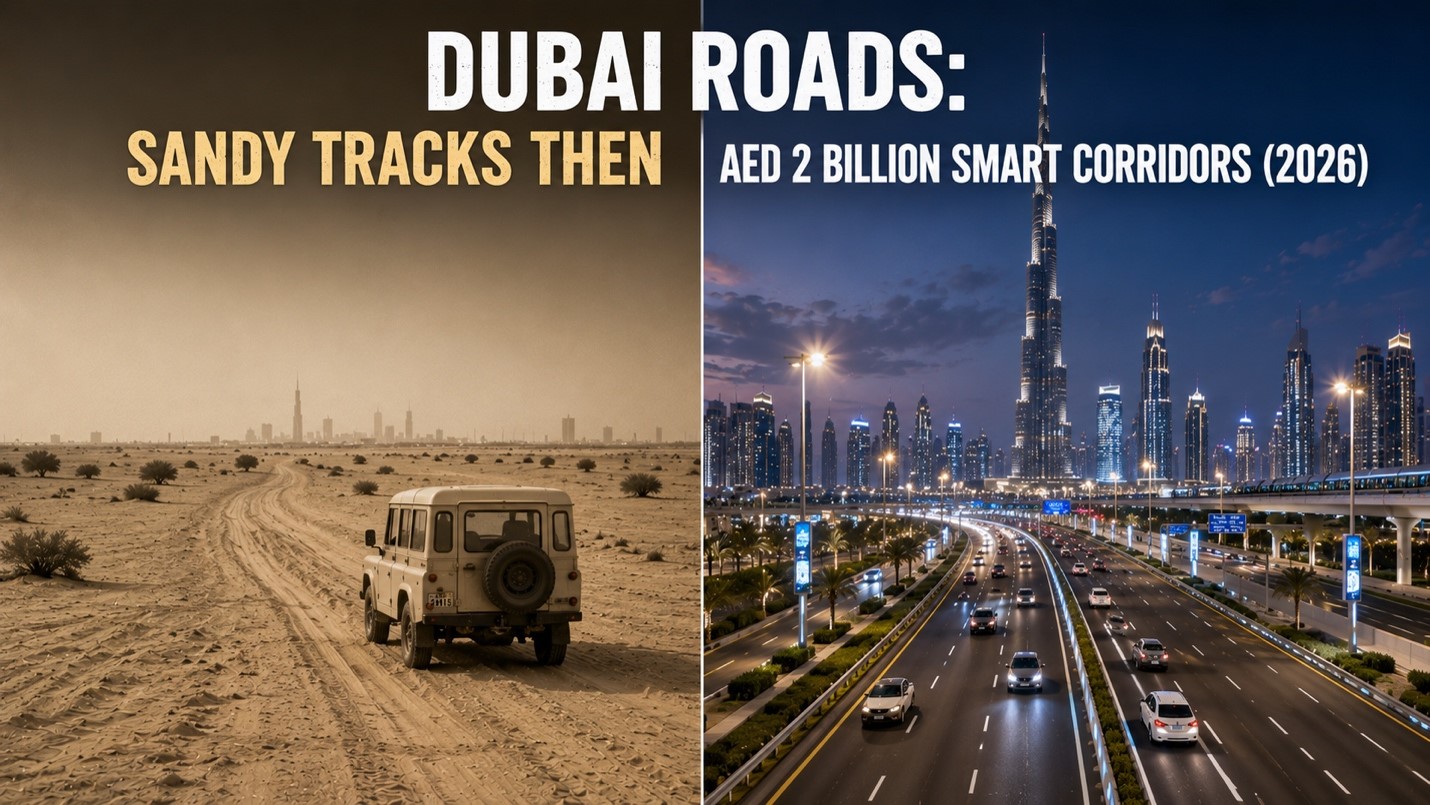
Then: When Dubai’s Roads Were Barely Roads at All
It is difficult to overstate how primitive the road network of old Dubai truly was. In the 1950s and well into the 1960s, most of what passed for roads in the emirate were nothing more than compacted sand tracks worn into the desert floor by the repeated passage of feet, animals, and the occasional motor vehicle. There were no road markings, no traffic signals, no kerbs, no drainage systems, and no lighting after dark. The tracks wound between buildings in the organic, unplanned way of all old settlements – following the lines of least resistance through the landscape rather than any master plan imposed from above. In the monsoon season, when rare but intense rains could turn the sandy ground to mud, even these basic tracks became impassable, cutting off communities from each other and reducing the city’s connectivity to whatever a person could manage on foot.
The first tarmac road in Dubai appeared in the early 1960s, a milestone that residents of the era remembered as a genuinely transformative moment in the life of the city. To have a paved surface underfoot, smooth and solid regardless of weather or season, felt like a declaration that Dubai was crossing a threshold into the modern world. But even this first tarmac was modest in scope, covering only the most essential routes through the creek-side settlements. The broader city remained a network of sand and gravel for years afterward, and the concept of a highway – a road designed for high-speed travel between distant points – did not yet exist anywhere in the emirate.
As oil revenues began to flow in the late 1960s and the government invested heavily in infrastructure, the road network expanded rapidly through the 1970s. New roads were laid, bridges were built across the creek to supplement the abra crossings, and the first highways began to appear along the coastline and the main arterial routes connecting the expanding city to the wider UAE. By the 1980s, Dubai had a road network that was modern by regional standards, though still dwarfed by what would eventually be built. Traffic management consisted largely of traffic police officers stationed at key intersections directing vehicles by hand, a thoroughly human system that worked tolerably well for the traffic volumes of the era but was clearly unsuited to the exponential growth the city was about to experience.
Now: AED 2 Billion Smart Road Corridors and Counting (2026)
In July 2026, Dubai’s Roads and Transport Authority awarded a contract worth AED two billion for the development of the twelve-kilometre Latifa Bint Hamdan Corridor, a project that exemplifies the scale and sophistication with which Dubai now approaches road infrastructure. This single contract – for a single road corridor in a single emirate – carries a price tag that would represent the entire annual infrastructure budget of many national governments, and it is far from the only major road project underway in Dubai simultaneously. The emirate’s commitment to expanding, upgrading, and intelligently managing its road network has not diminished with time. If anything, it has intensified, driven by a population that continues to grow and a government that continues to set standards for urban infrastructure that the rest of the world measures itself against.
The road network that Dubai operates in 2026 is not merely large – it is smart in ways that would have been inconceivable to the engineers who laid the first tarmac in the 1960s. Thousands of intelligent traffic sensors embedded across the road network feed real-time data to the Roads and Transport Authority command centre, where artificial intelligence systems analyse traffic flows, predict congestion, and adjust signal timing across thousands of intersections simultaneously without any human intervention. Journey times across the city are monitored to the minute, variable message signs advise drivers of conditions ahead, and incidents on the road network trigger automated responses that redirect traffic within seconds of detection. The road itself has become a data platform as much as a physical infrastructure.
The Salik toll system, which operates across key bridges and road corridors throughout the city, functions as both a congestion management tool and a revenue mechanism that funds continued road development, with rates adjusted on public holidays and peak periods to influence driver behaviour at a systemic level. Dubai’s road safety record has been transformed alongside its road quality – fatality rates per hundred thousand population have fallen dramatically over the past two decades, driven by better road design, stricter enforcement through automated cameras, and public awareness campaigns that have changed attitudes toward speeding and reckless driving in a culture where the open road was once treated as an invitation to press the accelerator to the floor.
From sandy tracks that turned to mud in the rain to a AED two billion smart corridor programme that delivers twelve kilometres of world-class road infrastructure in a single contract, Dubai’s road story mirrors every other dimension of its transformation. The distance between where it started and where it stands in 2026 is not merely physical. It is the distance between a city that moved with the pace of the desert and one that moves with the precision and ambition of a civilisation determined never to stand still.
Contributed by GuestPosts.biz